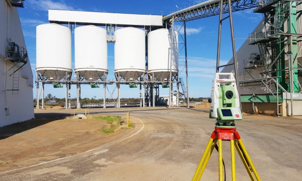
Feature Survey

Ensure your development’s success with RM Surveys' precise feature surveys, all tailored to meet design and government approval needs

Unlock Critical Data for Your Project with a Feature Survey

A feature survey, also known as a topographical survey, is essential for developments requiring design work or government approval.

This detailed survey captures all site improvements, utilities, and land contours, providing accurate levels relative to the Australian Height Datum (AHD). RM Surveys’ expert team ensures every important feature is documented clearly and concisely, tailoring the survey to meet your project’s specific needs.

Whether for architects or planning authorities, a topographical survey from RM Surveys ensures precise data, helping you move forward with a better understanding in your development plans.

Why a Feature Survey is Key to Development Success

A feature survey is crucial for ensuring accurate planning and design in any development project. It provides precise data on utilities, and land contours, allowing those involved in the development to make informed decisions and avoid costly mistakes. The survey also highlights levels relative to the Australian Height Datum (AHD), which is essential for flood risk assessments and compliance with local regulations. By capturing a detailed picture of your land, a feature survey helps prevent delays, improves project efficiency, and ensures smooth approval from planning authorities.

Feature Survey Projects

View all projects
project image
1 CBH Grain Terminals

RM Surveys was awarded the contract to complete five large feature surveys for CBH Group across the West Australian Wheatbelt. These surveys are part of CBH’s project to update plans for over 100 grain terminals in the region. We used a combination of below-ground service detection, drone photography, aerial capture, and comprehensive topographical surveys to deliver detailed and accurate plans for terminals in the Albany-Esperance Zone, supporting critical infrastructure improvements and development.

View more
project image
2 Quairading Airstrip and Sports Ground Precinct

RM Surveys conducted feature surveys for the installation of new floodlighting at Quairading Sports Oval, replacing temporary lighting solutions. Engaged from the pre-construction phase, we ensured that all standards for illumination, safety, and light placement were met. Surveys covered existing electrical infrastructure and nearby airstrip heights to ensure proper pole placement for aircraft safety. With extensive experience in “floodlight aiming” surveys, we have become a trusted partner for electrical contractors, providing assistance in lux lighting design, pole positioning, and electrical services installation throughout the Wheatbelt region.

View more
project image
3 Broome Senior High School $19.3m Upgrade

In the Broome Senior High School upgrade project, RM Surveys’ involvement in pegging the cadastral boundary, placing survey control, and setting out utility services and footings relates to feature surveying. These tasks require accurate mapping of existing site features, ensuring that new construction elements like earthworks, utilities, and concrete floors are correctly positioned according to the land’s existing contours and boundaries. This work highlights the importance of feature surveying in laying the groundwork for major construction projects.

View more

Frequently Asked Questions

Why do I need a feature survey for my project?

A feature survey is often required by architects, engineers, and local authorities to ensure accurate site planning. It helps identify potential issues and provides the data necessary for successful design, construction, and regulatory approval.

What happens if my feature survey reveals issues with my property?

If the feature survey identifies potential issues you can address them before proceeding with your project. This can save you time, money, and legal complications down the road.

What information is included in a feature survey?

The time it takes to complete a boundary survey varies depending on the size of the property and the complexity of the boundaries. Typically, it can take anywhere from a few days to a couple of weeks.

What is the difference between a feature survey and a boundary survey?

A feature survey focuses on mapping the physical features and contours of the land, including utilities and buildings, while a boundary survey defines the legal boundaries of a property. Both are important, but they serve different purposes in property development.